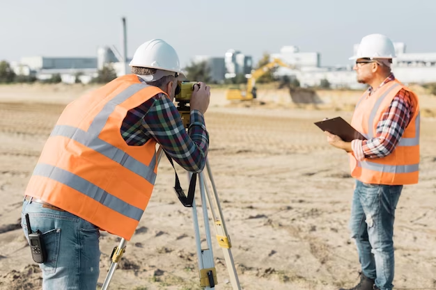
Utility Mapping Services for Safe and Efficient Projects
Modern construction and infrastructure projects rely heavily on accurate underground data. Without proper planning, excavation work can damage hidden utilities, delay projects, and increase safety risks. This is why professional Utility Mapping Services have become essential for construction companies, engineers, developers, and surveyors.
Using advanced technologies and experienced survey teams, Apex Engineering Services provides precise underground utility mapping solutions that help organisations avoid costly mistakes and improve project efficiency. From identifying buried pipes and cables to supporting digital site planning, utility mapping plays a major role in modern infrastructure development.
Whether it is a commercial building project, road expansion, or utility installation, accurate underground information helps teams work with confidence and reduce operational risks.
Why Utility Mapping Services Are Important
Construction sites often contain hidden underground infrastructure such as water pipelines, gas lines, electrical cables, fibre optics, and drainage systems. Damaging any of these utilities can result in serious safety hazards and expensive repairs.
Professional Utility Mapping Services help project teams:
- Locate underground utilities accurately
- Prevent accidental utility strikes
- Improve excavation safety
- Reduce project delays
- Support regulatory compliance
- Improve construction planning accuracy
By understanding underground conditions before excavation begins, contractors can make informed decisions and minimise disruption during construction activities.
Technologies Used in Modern Utility Mapping
Utility mapping has evolved significantly with the use of advanced surveying technology. Today’s mapping services combine digital accuracy with real-time site data collection.
Ground Penetrating Radar (GPR)
Ground Penetrating Radar is one of the most widely used technologies for underground utility detection. It sends radar pulses into the ground to identify buried structures and utility lines without excavation.
Electromagnetic Location Equipment
Electromagnetic tools help detect metallic utilities such as power cables and pipelines. This method is particularly effective for tracing underground electrical infrastructure.
GPS and Digital Surveying
Modern utility mapping integrates GPS technology and digital survey systems to improve mapping precision and produce detailed site plans.
Integration with HP SitePrint Service
Advanced digital workflows often combine utility mapping data with HP SitePrint Service solutions. This technology helps transfer accurate underground layouts directly onto construction sites, improving efficiency and reducing marking errors.
Benefits of Professional Utility Mapping Services
Accurate underground utility detection offers significant advantages for both small and large-scale projects.
Improved Site Safety
Underground utility strikes can lead to gas leaks, electrical hazards, and water damage. Professional utility surveys reduce these risks by identifying hidden infrastructure before excavation begins.
Reduced Project Costs
Unexpected utility damage often leads to costly repairs, penalties, and project delays. Reliable Utility Mapping Services help reduce unnecessary expenses by improving project planning.
Better Project Planning
Engineers and contractors can create more efficient designs when they understand underground conditions clearly. Accurate utility data helps optimise excavation and construction strategies.
Faster Construction Workflow
With clear utility mapping information, construction teams can avoid delays caused by uncertainty or emergency repairs during excavation.
Industries That Use Utility Mapping Services
Many industries depend on accurate utility surveys to complete projects safely and efficiently.
Construction and Infrastructure
Builders and contractors use Utility Mapping Services before excavation, foundation work, and road development projects.
Civil Engineering
Civil engineers rely on underground mapping to design drainage systems, utility connections, and transportation infrastructure.
Telecommunications
Telecommunication companies use utility surveys when installing fibre optic networks and underground communication lines.
Property Development
Developers need accurate utility information before beginning residential, commercial, or industrial construction projects.
The Role of Utility Mapping in Smart Construction
Smart construction methods rely heavily on digital accuracy and automation. Utility mapping contributes to this transformation by providing precise underground data that integrates with modern construction technologies.
Solutions like HP SitePrint Service are helping construction companies improve layout accuracy and reduce manual site marking errors. By combining digital utility data with automated site printing technology, teams can improve project coordination and efficiency.
This approach supports:
- Faster site preparation
- Improved layout consistency
- Reduced human error
- Better collaboration between teams
- Enhanced construction precision
As digital construction continues to evolve, utility mapping remains a key part of successful project management.
Choosing the Right Utility Mapping Provider
Not all utility survey providers offer the same level of expertise or technology. Choosing a reliable company is essential for obtaining accurate and dependable results.
Experience and Technical Expertise
Look for providers with strong industry experience and trained survey professionals who understand complex underground infrastructure systems.
Advanced Equipment
Modern surveying tools improve accuracy and data quality. Professional providers use advanced GPR systems, GPS equipment, and digital mapping software.
Detailed Reporting
Clear reports and accurate utility drawings help engineers and contractors make informed project decisions.
Commitment to Safety
Reliable companies like Apex Engineering Services prioritise safety and compliance while delivering high-quality survey solutions.
Practical Applications of Utility Mapping
Professional Utility Mapping Services support a wide range of real-world applications.
For example:
- Identifying underground gas lines before excavation
- Mapping drainage systems for road projects
- Supporting utility relocation planning
- Preventing cable damage during construction
- Improving foundation planning for commercial buildings
These services help reduce uncertainty and improve project confidence across multiple industries.
FAQs
What are Utility Mapping Services?
Utility Mapping Services involve locating and mapping underground infrastructure such as pipes, cables, and drainage systems before excavation or construction work begins.
Why is utility mapping important?
Utility mapping helps prevent utility strikes, improves safety, reduces project delays, and supports accurate construction planning.
What technology is used for utility mapping?
Common technologies include Ground Penetrating Radar (GPR), electromagnetic detection equipment, GPS systems, and digital survey tools.
How does HP SitePrint Service support construction projects?
HP SitePrint Service helps transfer digital construction layouts directly onto job sites with high accuracy, improving efficiency and reducing marking errors.
Why choose Apex Engineering Services?
Apex Engineering Services offers professional surveying expertise, advanced technology, and accurate underground utility mapping solutions tailored to modern construction needs.
Build Safer Projects with Accurate Utility Mapping
Underground utility information is essential for safe and efficient construction planning. Investing in professional Utility Mapping Services helps organisations reduce risks, improve project accuracy, and prevent costly delays.
With advanced technologies, experienced professionals, and innovative solutions like HP SitePrint Service, Apex Engineering Services supports smarter and safer construction projects across multiple industries.
Whether you are planning excavation, infrastructure development, or site preparation, reliable utility mapping is the foundation of successful project execution.