


How LiDAR Ground Control Targets Improve Surveying Precision
LiDAR (Light Detection and Ranging) has revolutionized surveying and mapping, providing highly accurate 3D data for a wide range of applications. Whether it’s for topographic mapping, forestry, or infrastructure planning, LiDAR systems offer precise measurements of landscapes, structures, and vegetation. However, to ensure the highest level of accuracy in LiDAR data, it’s crucial to establish ground control. This is where LiDAR Ground Control Targets come into play. In this article, we’ll explore how these targets improve surveying precision and the key factors that make them indispensable for LiDAR-based surveying projects.
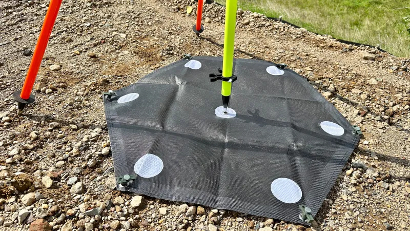
What Are LiDAR Ground Control Targets?
Ground control targets are physical markers placed on the ground with known geographic coordinates, typically expressed in a geodetic coordinate system such as latitude, longitude, and elevation. These targets serve as a reference point for aligning LiDAR data with real-world coordinates.
In LiDAR surveying, ground control targets are essential for georeferencing and calibrating the collected LiDAR data, ensuring it accurately represents the surveyed area. These targets help surveyors link raw point cloud data from the LiDAR scan to precise geographic locations, improving data accuracy and usability.
The Importance of Precision in LiDAR Surveying
Before diving into the role of ground control targets, it’s important to understand why precision is so crucial in LiDAR surveying. Here are a few reasons:
-
Accurate Mapping: In applications such as flood modeling, urban planning, or environmental studies, even slight inaccuracies in LiDAR data can lead to significant misinterpretations. Precision ensures that the models created from LiDAR data are trustworthy.
-
Legal and Regulatory Requirements: Surveying often involves legal frameworks that require exact measurements, especially in construction, land development, and civil engineering projects. Having precise data is essential to meet regulatory standards and avoid costly mistakes.
-
Cost Efficiency: Inaccurate LiDAR data can require additional surveys or reprocessing, both of which increase costs and project timelines. By ensuring high precision from the start, LiDAR ground control targets help minimize these risks.
How LiDAR Ground Control Targets Improve Surveying Precision
1. Georeferencing and Alignment of Data
LiDAR systems capture data as a point cloud, which represents the 3D coordinates of points on the surface of objects. However, this raw data is not inherently tied to geographic coordinates. Without proper georeferencing, the point cloud data could be displaced or misaligned when overlaid onto maps or other GIS datasets.
LiDAR ground control targets provide known reference points that allow surveyors to align the raw data to the Earth's coordinate system. These targets are surveyed using traditional geodetic methods (like GPS or total stations) to determine their exact positions. When LiDAR data is captured, it can be aligned or corrected using these known positions, ensuring its accuracy.
2. Compensating for Systematic Errors and Sensor Calibration
LiDAR sensors are subject to systematic errors, including inaccuracies in positioning, tilt, or misalignment. These errors can occur due to several factors, such as sensor drift, atmospheric conditions, or platform motion (drone, aircraft, or terrestrial scanner) during data collection.
By utilizing ground control targets, surveyors can calibrate and correct these errors. The known positions of the targets allow for accurate adjustment of the LiDAR data to account for any discrepancies in the sensor’s measurements. This process significantly reduces errors and improves the dataset's overall accuracy.
3. Improved Vertical and Horizontal Accuracy
While LiDAR systems are known for their high precision in collecting 3D data, vertical and horizontal accuracy can be compromised by factors such as platform motion or environmental interference. By integrating LiDAR ground control targets into the survey process, surveyors can improve both the vertical (elevation) and horizontal (X and Y coordinates) accuracy of the data.
The ground control targets help surveyors make corrections to LiDAR data, ensuring a more accurate representation of elevations and locations. This is especially important in applications such as topographic mapping, land elevation modeling, and floodplain analysis, where small elevation inaccuracies can have significant implications.
4. Enhancing Data Integration
LiDAR data is often used in conjunction with other geospatial datasets, such as aerial imagery, CAD models, or GIS layers. For seamless integration, the LiDAR data must be accurately aligned with these datasets. Ground control targets serve as key reference points to help align the LiDAR data with other sources of information.
This integration is essential for applications such as urban planning, where LiDAR data may need to be combined with zoning data, infrastructure maps, or 3D models of buildings and roads. With precise ground control points, surveyors can ensure that all data layers align perfectly for accurate analysis and decision-making.
5. Reducing the Need for Post-Processing Adjustments
One of the major advantages of using ground control targets during the LiDAR survey is that they reduce the need for extensive post-processing adjustments. When the data is collected with accurate georeferencing from the outset, the need for time-consuming and costly adjustments after the fact is minimized.
This not only speeds up the project but also reduces the potential for human error during data manipulation. When ground control targets are not used, surveyors may need to spend additional time manually adjusting the data to fit reference points, which can introduce further inaccuracies.
Conclusion
LiDAR ground control targets play a pivotal role in improving surveying precision. From georeferencing and aligning raw LiDAR data to compensating for systematic errors, these targets ensure that the data is accurate, reliable, and ready for integration into larger geospatial datasets. By incorporating ground control targets into your LiDAR surveying process, you can minimize errors, improve accuracy, and enhance the quality of the final deliverables, all while saving time and resources.
Categorias
Leia Mais
October’s Very Own Premium streetwear and lifestyle brand that has made a powerful impact on global fashion. Founded by Drake alongside Oliver El-Khatib and Noah “40” Shebib, the brand represents a seamless October's Very Own of music, culture, and high-end streetwear. The name itself reflects Drake’s birth month—October—and carries a deeper meaning...

"Global Demand Outlook for Executive Summary Europe Application Container Market Size and Share Data Bridge Market Research analyses that the application container market is expected to reach the value of USD 11,434,397.79 thousand by 2030, at a CAGR of 31.6% during the forecast period.Global Europe Application Container Market report is a highly visual business report where the key...
Long before chess captivated screens, a young Hungarian girl named Judit Polgár set her sights on the ultimate crown. Her target was not merely victory, but to shatter the grandmasters' glass ceiling, dominated by men who doubted women's brilliance. The film "Queen of Chess" chronicles this ascent, from a childhood shaped by a unique experiment to becoming the world's youngest...

Introduction In today’s fast-paced and uncertain economic climate, financial planning has evolved from being a luxury to a necessity. Whether you’re a young professional just starting your career, a business owner managing cash flow, or a retiree safeguarding your savings, a well-crafted financial plan can be the difference between financial stability and financial stress....

The rental market in London, Ontario is evolving rapidly in 2026. After several years of extremely low vacancy rates and intense competition among renters, the market is becoming more balanced. New rental supply, changing immigration patterns, and shifting tenant expectations mean landlords can no longer rely solely on market demand to keep units occupied. For rental property owners, this shift...
